Showing posts with label Randonneuring. Show all posts

Tuesday, July 31, 2012

Three Volcanoes 300k Pre-ride: Better than Perfect

Mt. Adams from Babyshoe Pass
Can a bike ride be too perfect? I was mulling over this question, and the nature of perfection in general (gettin' all filosofical and shit) as I did the pre-ride for the Seattle Randonneurs Three Volcanoes 300k last Saturday.

Lonely Roads - Approaching Elk Summit

The Three Volcanoes 300k has everything I love in a good long bike ride. The roads are as remote and car-free as anything you could hope for in this part of the world. Views of snow capped volcanoes and sparkling streams abound. A variety of climbs, some short and steep, some long and relentless, others with occasional rest stops as they step up in gentle stages keep you physically challenged. Thrilling winding descents pay you back (plus interest) for your sweaty investment in the climbs. Mossy old massive Douglas firs keep you shaded and cool when the sun comes out.

Descent from Babyshoe Pass

But in addition to the things I love in a ride, the 3 Vs also throws some challenges at you. About 10 miles of unpaved road as you climb up and over the summit of Babyshoe pass is rutted and dusty. 9% grades with loose gravel over nasty washboard make it tough to keep traction. On the unpaved descent from Babyshoe, the loose gravel gets deep enough in places to make a skinny-tired road bikes whimper. Occasional cracks and potholes in the paved sections hide in shade and threaten to swallow your front wheel whole if you don't pay attention.

Mt. St. Helens from Near Elk Summit

As I was struggling with the climb over Babyshoe pass I was thinking about how without the dusty unpaved 10 miles, this ride would be so perfect as to be downright boring. It would be like a rose without thorns. Like a big wad of cotton candy dipped in hot fudge, way too sweet to stomach. But there was Babyshoe pass with its deceptively innocent sounding name. The wasabi on the sushi. The olive in the Martini.

It's the the 3 V's imperfections that make it a perfect ride.

Wait a second... That makes no sense at all. Perhaps I should stick with randonneuring. My filosofer skillz aren't so great.

Anyway, whether you call it perfect, or perfectly imperfect, or just fabulously flawed (like most of my favorite people), I have to say that the Three Volcanoes 300k was among my favorite bike rides ever.

Monday, July 23, 2012

Look What Came in the Mail


One of the many fun things about randonneuring is that you can get some really neat shiny medals and trinkets as hard evidence of your suffering. It sort of reminds me of the merit badges I got when I was a Boy Scout except that there was usually far less suffering involved then. Well, actually I never really earned many merit badges because I discovered girls about the same time I got into Boy Scouts and quickly lost interest in knot tying, canoeing and coin collecting.

Anyway, it would seem I'm a better Randonneur than I ever was a Boy Scout (which isn't saying much). After signing up for the Golden Gate 1000 earlier this spring, I realized that if I finish it I will have qualified for the RUSA Cup award. The RUSA cup is earned by essentially doing one of just about every type of event that you can do as a Randonneur in the USA. To qualify you need to do the following within a two year period:

  • 100k populaire
  • 200k, 300k, 400k, 600k and 1000k brevets
  • team event (Fleche or Dart)
  • 1200k Grand Randonnée
  • other calendared events adding up to at least 5000k

I wasn't really going after the award but I managed to do all that over the past two years, so for my efforts (and $25 plus shipping and handling) I get the shiny mug pictured above with my name engraved on it. It's not exactly the Eagle Scout of Randonneuring, but then you can't drink beer out of an Eagle Scout medal, can you?

Monday, July 2, 2012

Golden Gate 1000: Taking Time to Smell the Roses On a Death March

The other evening a friend asked me how the Golden Gate 1000 went and - without thinking at all what came out of my mouth was: “it was a death march… with nice scenery.” With these big rides, my feelings about the ride seem to vary wildly depending on the mood I’m in at the moment and the parts of the ride that are foremost in my memory. Obviously that evening, when asked, I was remembering some of the less pleasant parts of the ride. But to be fair, there was much more positive than negative about the ride. My friend just happened to catch me somewhere on the coast highway in the driving rain, climbing an 8% grade into a headwind with no shoulder and a semi blasting by.

Day 1
We gathered Thursday morning in downtown San Jose for a 5:30 AM start. There were 27 riders in total doing the Golden Gate 1000 and I was the only non-local, everyone else was from one of the four bay area randonneur clubs. Rob Hawks, the San Francisco Randonneurs RBA very kindly introduced me during the pre-ride announcements and asked the others not to make too much fun of the fenders on my bike seeing as how I was from Seattle and didn't know any better (which of course they immediately all did, but boy would they regret that later). After some more pre-ride announcements Rob led us in an oath that essentially had us promising to do nothing stupid out on the roads, and with that we were ready to roll.

Starting the Climb up Mt. Hamilton

The View from Mt. Hamilton

After a few minutes of meandering through San Jose, we were on the edge of town and starting the climb up Mt. Hamilton. I had spent some time prior to the ride worrying a bit about the climb, but the worrying was unnecessary as it turned out to be one of my favorite parts of the ride. The sun wasn't fully up yet, so it was cool and comfortable for climbing. The road up Mt. Hamilton was almost totally car free and twisted and undulated like the dancers in a Lady Gaga video. Never terribly steep, the road ascended at a moderate pace with a couple brief reprieves until we finally could see the Lick Observatory at the summit.

Lick Observatory

At the Summit

After the summit the sun was up in the sky and the temperature quickly rose from the 50s to the 80s almost completely skipping the 60s and 70s. The descent down the back side of Mt. Hamilton is like an E ticket ride at Disneyland with banked hairpin turns and bumps and dips galore. Eventually the road levels off some and starts meandering northward toward Livermore. When I say "levels off" I mean that in a macro sense rather than micro sense. That road is constantly going up or down, but doing it in fairly equal amounts.

I mostly rode alone through the morning and early afternoon, occasionally seeing other randonneurs and chatting briefly, but with the constant ups and downs it was difficult to form any lasting alliances. After Livermore the route dipped into the suburbs here and there but still spent most of the time on quiet rural roads and slowly worked its way past Pleasanton, Dublin, Castro Valley, Moraga, Orinda, Pinole, and finally across the Carquinez Bridge to Vallejo.

The Carquinez Bridge

By late afternoon I was entering wine country, through the Suisun and Wooden Valleys and then over the ridge and into the heart of the North American wine universe, the Napa Valley. I haven't done any research to prove or disprove this theory, but I suspect the average blood alcohol level of Napa Valley drivers late in the day is similar to that of sailors on shore leave. I had no close calls, but did notice a couple drivers who seemed to feel overly constrained by the lines on the road.

Entering Wine Country

Coming Over the Ridge into the Napa Valley

As always happens somewhere on a long ride, time began to slow to a crawl as the sun was sinking over the Napa Valley. The vineyards were all looking alike and my cycle computer was counting the distance travelled in inches rather than miles. At least the riding was easy as it was flat and windless through the valley, but every minute seemed to take a week.

Sun Setting Over the Napa Valley

One thing that's helped me in the past to get through these randoneuring time warps is to have a mental "project" to work on. So, I went looking for a project. This is a little embarrassing to admit, but there was a time in my life when I knew every lyric to every song on Elton John's Goodbye Yellow Brick Road album (come on we were all thirteen once, right?). Those song lyrics were buried deeply, but with hours to kill it seemed like the perfect project to attempt to dredge up every verse, every chorus, every bridge from Love Lies Bleeding to Harmony... beginning to end. Dirty Little Girl, Candle in the Wind, Roy Rogers, Sweet Painted Ladies... the whole double album. I can't say I was successful in remembering every song, but the project accomplished exactly what it was intended to accomplish. Time started to fly by as I meandered through the valley belting out "Some punk with a shotgun... killed young Danny Bailey... in cold blood... in the lobby of a downtown motel..." into the darkness. I stopped for a quick convenience store dinner in Calistoga and then continued on into the night, "Your sister can't twist but she can rock and roll... she out bucks the broncos at the rodee-doe-doe... she's only sixteen but it's plain to see.. that she can pull the wool over little ol' me..."

"Goodbye Norma Jean... Though I never knew you at all you had the grace to hold yourself..."

When I finally pulled into the overnight control at the Best Western in Cloverdale a few minutes after midnight, I was almost disappointed that I had to stop singing Elton John songs. Almost. I chatted with the volunteer support team while gobbling a couple bowls of chili and then made my way to my hotel room for a quick shower and all the sleep I could manage to squeeze in between then and when my alarm would go off at 4:30 AM the next morning.

The numbers for day one:
Distance: 241.2 miles
Rolling Time: 16 hours 12 minutes
Total Time: 18 hours 40 minutes
Climbing: 14,206 feet

Day 2
After three blissful hours of sleep my iPhone reminded me that I had another full day of riding ahead of me and this was no time for sleeping in. I dug out the clean clothes, grabbed some breakfast, loaded up my bag with food for the day, grabbed a quick look at the forecast for the coast and... crap! The forecast was for temps in the mid 50s and rain all up and down the coast all day. Oh well, I'm a Seattle randonneur! I can't let a little rain ruin my day. Besides I've got fenders on my bike! So I added a couple more layers to my kit and headed out the door.

Awake, more or less

After a couple of false starts (first I headed the wrong direction from the hotel for about 10 minutes, then after I turned around, retraced my route and got back on course, I realized I had left my phone back in the hotel room) I was on my way toward the California coast on CA-128 with the sun just starting to peak over the hills. At least in Cloverdale it was shaping up to be a nice day.

Sunrise Over Cloverdale

CA-128 would be a lovely cycling road if not for the fact that it generally has no shoulder, and lots of logging trucks, semis, RVs and the like blaze by at 60 mph refusing to yield more than a few inches of the road to us annoying cyclists. For the first hour or so the traffic wasn't too heavy, but by a couple hours into my day I was routinely getting strafed. It was a welcome respite when I pulled into Boonville around 8:15 AM where the town was absolutely hopping. Boonville was hosting a Roots Reggae/World Music festival and every hippy, former hippy, hippy wanna-be and hippy-like person from several western states had converged there and was at that moment crawling out of their tents and VW vans in the Mendocino fairgrounds and wiping the schmutz out of their eyes. The smells of frying bacon and dank bud filled the morning.

My Favorite Sign

After breakfast #2 in Boonville I pushed on, braving the aggressive truck traffic. As CA-128 entered a grove of coastal redwoods, the rain began to fall, lightly at first, but with bigger and bigger drops as the coast got nearer. By the time I reached the junction with CA-1 and turned north toward Fort Bragg, it was neither misting nor sprinkling nor showering intermittently. It was just plain raining.

The Coast at Last

In spite of the rain and the continuing heavy traffic, I made great time up the coast to Fort Bragg where I stopped in at the Safeway for lunch. I had been attributing my blistering pace to good genetics and exceptional physical conditioning until one of the other randonneurs I met there pointed out the fact that we had been riding with a brisk tailwind for the past 40 miles. That was a bit of a downer for two reasons:

1. It meant I wasn’t really pro peloton material.

2. Fort Bragg was the northern most point on the route. From there we would head south into a headwind for the next 100 miles before the route would finally turn inland and give us any hope for a break from the wind.

Fort Bragg Harbor

Typical CA-1 Traffic

Scoping Out Potential Burial Places

The trip down the coast highway from Fort Bragg to Jenner stands out as the longest, slowest 100 miles (well, actually only about 97 miles but who's counting?) I’ve ever traveled by bicycle. I left Fort Bragg at 12:30 PM, and it was 10:30 PM before I finally made the turn inland on Hwy 116. Nine of those ten hours were filled with a Sisyphean pattern of slowly climbing the 7% – 8% grade of the shoulder less highway up and over a 100' – 300' high coastal headland, where once on top and fully exposed, the headwind would reduce my already slow progress to an even slower crawl, and then as I’d start descending the twists and turns on the other side of the headland, trailer towing motorhomes would do their best to force me off the road at every opportunity. Then you repeat the process about 30 more times. And did I mention it was pouring rain for most of this? To make the last few miles particularly memorable, after the sun went down the rain was replaced by impenetrable pea soup fog.

Elevation Profile - Fort Bragg to Jenner

Of course, the whole point of a randonneuring ride report is to take this awful stuff and make it sound even worse than it really was. So to be fair, that ten hour stretch wasn't entirely without some rose smelling and rainbow pots o' gold. For example, my dinner stop in Gualala was a little taste of rando heaven. About the only choice for food in town was something you might get if you put a Mexican taco truck in a blender with a pizzaria, a road side burger joint and a French bakery. The menu offered burritos, chili cheese fries, bacon cheese burgers, pepperoni pizza and much more. For dessert you could have pain au chocolat, chocolate chip cookies, churros... It was like the United Nations of fast food. I ordered the chili cheese fries without hesitation and had no regrets.

The Best Chili Cheese Fries in Gualala

After leaving the coast, the journey back to Cloverdale was mostly uneventful. The rain and wind had stopped, the fog had cleared, the truckers and RV captains were snug in their beds, and most of the day's hills were behind me on the coast where they would give hell to a new batch of cyclists tomorrow. I arrived back at the Cloverdale Best Western feeling more than a little beaten down at 2:45 AM.

I rode alone for the entire day, only seeing other randos briefly when I stopped in Boonville and Fort Bragg. But apparently I wasn't the only one who had had a tough day. The next morning I heard that of the 27 riders who started in San Jose, ten chose to abandon the ride on Friday.

The numbers for day two:
Distance: 222.7 miles
Rolling Time: 17 hours 18 minutes
Total Time: 20 hours 33 minutes
Climbing: 12,256 feet

Day 3
It doesn't seem right that you should pay full price for a hotel room when you only sleep in the bed for an hour and a half. There. Got that off my chest.

Day three's route started by retracing the previous evening's (or morning's) journey in reverse, back out to the coast on Dry Creek Rd, Westside Rd and River Rd/Hwy 116. It was nice to be able to do this in the daylight since it had all been in the dark on day two. Westside Rd was especially beautiful as it moseyed through vineyards and passed dozens of wineries.

Back on the Road - Day 3

Westside Rd. - Winery Central

As I was approaching the coast I was feeling pretty good (I mean that in the relative sense, of course), except that I was noticing a little twinge of pain in my right Achilles tendon. The twinge was getting worse and worse until it got to be downright painful whenever I really pushed on the pedals. I tried pedaling one legged for a while, but that made my left leg tired very quickly so I realized that with over 100 miles remaining, my only hope was to just take it easy and soft pedal my way into the finish control in San Francisco.

Once back to the coast the soft pedaling idea was not working out so well since the coast highway continued its "lather, rinse, repeat" cycle of climbing 100' to 300' headlands over and over again. Every climb taunted me to stand up and attack. But every time I tried to ignore the pain and push on hard, I was reminded that my 52 year old Achilles would have no part of that crazy "HTFU" thinking. So, with plenty of time in the bank (I essentially had 20 hours in which to complete the last 100 miles) I finally settled into to rose-smelling mindset and started just enjoying the scenery.

Unfortunately the scenery was pretty much lost in the fog.

Fog on the Coast

The fog disappeared as I headed inland toward Petaluma. Approaching Petaluma I realized that I was in the bay area's weekend warrior training ground. Every few minutes I was passed by another dentist on a $10,000 bicycle. I have nothing against dentists or $10,000 bicycles, it was just a little hard to let them all pass me without putting up a bit of a fight. But with my Achilles tendon still complaining there was nothing I could do but let them go by and admire their Dura Ace drive trains and laterally-stiff-yet-vertically-compliant carbon fiber frames.

You'd think with all those dentists on $10,000 bicycles roaming the Marin countryside that the locals would be pretty numb to the sight of cyclists in their funny lycra get ups, wouldn't you? Apparently not. In the town of Petaluma I had stopped in at the 7-11 to get my receipt for the brevet card. As I was heading out the door to get back on my bike, a tall thin young man in cowboy hat had just hopped out of his pickup truck and was headed into the store (probably for a half-rack of Coors Light). He puposely stopped right in front of me, semi-blocking my way, gave me a sort of sideways wise-ass grin and said, "do you sometimes feel like you're Lance Armstrong?" Of course, in this kind of situation I always think of about a hundred extremely witty comebacks, but I tend to think of them all about a minute or two too late. All I could come up with at the moment was, "yeah, a little."

After Petaluma I made my way back to Tomales bay where I was tempted by every oyster shack I rode past. I wanted to stop to enjoy some oysters and a big pile of french fries, but at the same time I was starting to smell the barn so I decided to push on and just be done with this big adventure.

Tomales Bay

Approaching Inverness

I got into Fairfax at about 9 PM and mistakenly thought that from there it was a short trip to the Golden Gate bridge and then a few blocks to the finish. Point of fact: there were 37 cues remaining on the cue sheet from Fairfax to the finish in downtown San Francisco. And as it turned out, that wasn't nearly enough cues to tell me what I still needed to do to get to the finish. The last ten miles was by far the most complicated maze I've ever had to navigate on a brevet of any kind. The nice folks of the San Francisco Randonneurs had warned me that this part of the route would be a bit complicated, but oh my, I had no idea. I ended up riding most of the last ten miles with my iPhone in one hand, watching the little blue dot as it moved from one block to the next and trying to figure out how to get that blue dot over the bridge from Marin county into San Francisco.

But eventually I got onto the bridge, and yes - the trip across all by myself at 11 PM was absolutely glorious, with angels singing from the bridge towers and all.

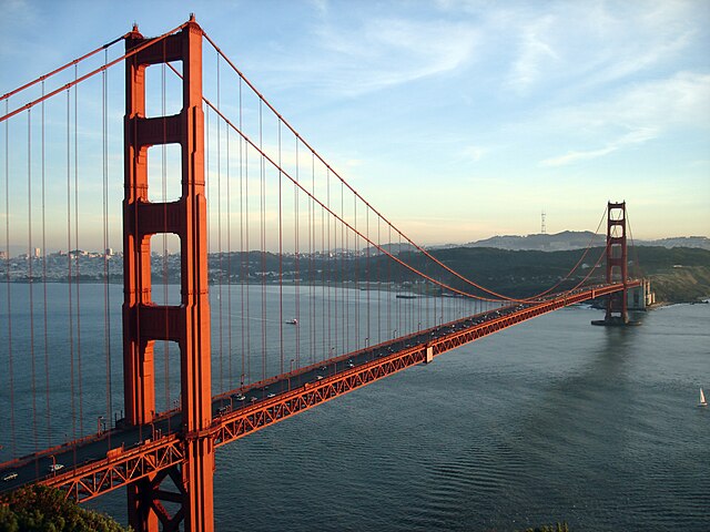
The Golden Gate Bridge - At Last

I pulled into the final control at the Motel Capri at 11:15 PM. The last 15 miles had taken me over two hours, so it wasn't my best pace ever, but hey this is randonneuring, it's not racing. Done under the time limit is all that matters.

The numbers for day three:
Distance: 173.05 miles
Rolling Time: 13 hours 52 minutes
Total Time: 17 hours 08 minutes
Climbing: 7,581 feet

Epilogue
It's a week later now and my Achilles tendon is fine; a couple of days off the bike seemed to be all it needed. Looking back on this ride, I'm amazed by the beauty of the landscape I rode through. Bay area cyclists have so much great riding in their back yard!

The San Francisco Randonneurs put on a great event. The route was definitely a challenge, but it was also an excellent showcase of the wide variety of riding the bay area has to offer. I've always been impressed by the organization and support on Seattle Randonneur rides, but without any basis for comparison I just assumed that no other club could compare. Now I know that San Francisco randonneurs are easily as spoiled as we are in Seattle (excepting the fact that they are total wimps when it comes to rain ;)). Thank you to the San Francisco Randonneurs and your great volunteers who took such great care of me for three grueling days!

Monday, June 11, 2012

Next up: Golden Gate 1000k


Now that I've completed a Super Randonneur series I have just one more big ride on my agenda for the year. That's not to say that I won't be doing other brevets, but at this point there's only one that I'm definitely committed to riding. Any others beyond that will be on a more ad hoc basis--if I happen to be free that weekend and the route looks interesting... if not, no big deal. The big ride yet to come is the San Francisco Randonneur's Golden Gate 1000k. I'm really looking forward to this ride. This will be my first US brevet organized by a club other than SIR. I'm excited to ride through some new terrain with a new group of randonneurs. This will also be my first 1000k, and 1000k is the only brevet distance I've never done. I suspect it will be a lot like riding a 1200k, but still it will be nice to be able to say I've done them all. Plus, if you do all the different types of randonneuring events within two years, you can get a really cool trinket.

RUSA Cup[

Since I rode the SR series this spring on my single-speed Trek, it seemed obvious to me that that's the bike I would use for the Golden Gate 1000k too. But that was before I had really looked into the route (Day 1, Day 2 and Day 3). The route starts from downtown San Jose and immediately spends the first 25 miles climbing over 4,000 ft to the summit of Mt. Hamilton (home of Lick Observatory). That's a brutal climb on a single-speed. Maybe I could make it to the summit of Mt. Hamilton, but I'm afraid I wouldn't have much left for the remaining 600 miles of the ride (which also have a few ups and downs). Since the idea is to have fun and ride with other people, I've decided to ride a bike with those new-fangled "derailleur" things on it. I've been told the derailleurs and "gears" make going up hill nearly effortless.


So, it's time to dig my Velo Orange Randonneur out from the basement where it's been sitting behind the Christmas tree ornaments and 1990s bank statements. To be honest I did ride it once back in February, but just once. Out of nearly 4,000 miles I've ridden so far this year, all but about 100 of those miles were on my humble, devoted, always-eager-to-please, single-speed Trek.

Which brings up a source of a little bit of anxiety for the GG 1000k. It's sort of like getting a new bike two weeks before riding 1000k. Rule number one of randonneuring is you never change anything about your bike immediately before a big ride (or maybe that's rule number two, rule number one having something to do with being discreet about where you stop to pee). The VO Rando and I have a history together, but it's been a while. The fit is pretty different from the Trek, and I haven't had the spring SR series to make sure I've got all of the mechanical bits properly lubed, adjusted, tightened, lock-tited, duct-taped and zip-tied. Oh yeah, I also got a new saddle for it since the one that was on it before gave me saddle sores on PBP, and the corollary to rule number one (or is it two?) is "especially don't mess with the saddle!" So, I guess I'll set to riding the heck out of the VO over the next couple of weeks to try to sort out any issues and get acquainted again.

Wednesday, June 6, 2012

SIR Spring 600k: Put a Forks in it

Welcome to Olympic National Park

It was on the road between Forks and La Push that I first noticed the moon. It was last Saturday night, and I was about 380 kilometers into the Seattle Randonneurs’ Spring 600k. The night was dark with few stars visible, the only light for miles coming from my trusty headlight and taillight and the running lights of Chris Cullum, my Canadian riding partner who I had been riding with off and on for the past 300 kilometers. Suddenly there it was: the full* moon shining through a gap in the clouds like a saucer of vanilla flavored Ensure Plus®. Then it all clicked in my head (by this point nearly as cloudy as the night we had been riding through). The full moon… The nearby town of Forks… Vampires! Werewolves! What was I doing out here!? I didn’t actually read any of the Twilight saga, but I saw the movies (well, part of the first one anyway)! I know what evil, wrapped in sparkly skin and designer jeans lurks in this damp corner of Washington state!

Ward and Gary on the road near Matlock

A few minutes later the wave of panic passed as I realized that even if vampires were real, they would probably do their best to stay away from Forks. Way too many Twifans hanging around these days. A more well-founded panic returned a little while later as I realized that it was Saturday night and Forks was the only town around with a bar. It was rapidly approaching the drunk driver witching hour, not a good time to be on a bicycle.

In spite of vampires, werewolves, drunk drivers, bad convenience store sandwiches, occasional headwinds and lots of lactate in my thigh muscles, I managed to complete the SIR 600k brevet last weekend. It was an incredibly beautiful route that circumnavigated the Olympic mountain range in a huge clockwise lumpy circle beginning and ending at the ferry dock in Kingston.

Shadow riders

Riding a single speed bike throughout the SR series this year has often made it difficult to find well-matched riding partners, but this time I managed to ride with others at a very compatible pace for about half of the distance. Chris in particular turned out to be an excellent riding partner, happily pulling me through endless rolling hills.

The view from Kalaloch

Every long brevet has it's warts and imperfections, but I really can't think of much about which to complain. Yes, there was a brief rain shower or two. But come on, we were riding through miles of Pacific Northwest rainforest in early June! What do you want? Maybe that last stretch of highway 104 from 101 to Kingston with the hills that took a couple of cheap shots at me when I was down on the ground? But that's not the hills' fault. They were there long before we decided to ride our brevet and they'll be there long after my trusty Trek has turned to dust and returned to the earth. Honestly I have to say this was my favorite 600k yet, and maybe my favorite brevet ever.

Some highlights for me:
  • The excellent homemade chocolate chip cookies at the Hood Canal control (Jennifer's recipe and Kole's execution).

  • It was steeper than it looks, honest

  • The lovely rolling, car-free back roads between Matlock and Humptulips, especially that steep dirt section that forced me to use my "granny gear" (i.e. get off and walk).

  • Okay, this is for real: In the Matlock General Store the clerk found $40 on the floor and asked if it was someone in our group who had lost it. None of the group I was with thought it was ours. Then at the very next stop in Humptulips, 45 miles down the road, as I was walking to the cash register there on the floor at my feet... two crisp $20 bills. They weren't mine. I asked if anyone in my group had dropped them, but none of us had even come in with two twenties. Weird. I left them with the cashier and walked out wondering if the same $40 would be following us all the way around the Olympic peninsula.

  • Chris and I helping a woman with a flat tire along 101. I'm convinced that woman would still be there trying to figure out how to fix that flat if we hadn't stopped (not exactly a whiz bike mechanic). She said she was riding to San Francisco. She'll either develop some bike mechanical skills along the way or continue to depend on the kindness of strangers.

  • "Dinner" at Kalaloch

  • Celebrating the first real view of the ocean at Kalaloch with a dish of soft-serve ice cream.

  • Leaving Forks at 2:30 AM

  • Making the most of the Forks control by stopping there not once but twice. The first time for an excellent bowl of homemade chicken soup to fortify me for the out-and-back to La Push. Then for a fiery bowl of chili and a couple hours of sleep before setting off again at 2:30 AM for last third of the route.

  • The quiet and lonely slog from Forks up to the control at mile marker 218.7 in the wee hours (Chris and I had parted ways at Forks and from there on I rode alone). Perhaps I saw three cars in an hour and a half. A great time for introspection and loud off-key singing.

  • But even better was the oasis at mile marker 218.7 with hot chicken soup and friendly faces.

  • Just before the sunrise on Lake Crescent

  • Watching the black night turn to grey daylight as I rode along the shores of Lake Crescent.
  • East Bank Rd!

  • Dungeness Spit from the stone bench

  • Sitting on the stone bench overlooking the Dungeness spit and reveling in the knowledge that there was little between me and Kingston that could keep me from finishing the ride (but naively unaware of the hills on highway 104 I had yet to ride).

  • The feeling of rolling into Kingston shortly after noon having just finished the brevet and a complete SR series on a single speed bike, not too mention it being my second fastest 600k ever. Of course, my spirits fell quickly when I realized I still needed to walk up a flight of stairs to the second floor motel room to get my card signed.
This was really a great ride for me from beginning to end. I felt strong the whole way and was rarely bothered by aches and pains. My bike worked well and nimbly avoided any broken glass and other sharp road debris that conspired to deflate my tires. The route was one I've wanted to ride ever since I started randonneuring. There's something about the remoteness and the idea of going all the way around an entire range of mountains that inspired me. I rode with some good riding partners who shared the hard work, some for a few minutes, others for hundreds of kilometers. Thanks to Chris, John, Gary, Ward and the others I rode with briefly. Most importantly, thanks to Kole and Jennifer, and the many other SIR volunteers for putting on an outstanding event.

*Okay, it wasn’t really officially a full moon until the 5th, but three days away from a full moon looks pretty darn full.

Tuesday, May 15, 2012

SIR Spring 400k: The Ferry Waits for No Man

The running lights of the last ferry of the night may have still been visible from the ferry dock as I pulled into the final contrôle of SIR's Spring 400k brevet. I didn't bother looking for the ferry because I knew I had missed it and besides, there was a slice of pizza and a cold beer with my name on it at the contrôle. My card was signed at 11:53 PM. The ferry had sailed at 11:40 PM. For the most part I rode as fast as I had hoped to ride, but I just dawdled a bit too much at a couple of the contrôles.

We couldn't have asked for a better day to spend riding hither and thither. It was 48 degrees when I left the house in the morning and it got into the low 80's by late afternoon. The winds out of the NE meant we had tailwinds for much of the morning and early afternoon until the route turned around in Raymond and headed back North. On the trip back north, the wind wasn't quite as helpful. It slowed things down a bit, but really not as much as I had feared.


On the Ferry
A crowd of about 55 turned out, and like two years ago when we rode the same route in similar conditions, many were looking to do a time (that's randospeak for "ride really fast"). Not two miles into the ride I realized that I'd have no hope of staying with any fast groups. The tailwinds and early ride adrenaline were pushing many along at 25 mph. That had me spinning my 68 gear inches of single speed goodness at over 120 rpm. It was too early and I hadn't had enough coffee for that sort of thing, so I let the faster groups fly on by and I drifted toward the back of the pack.


 Leaving Bremerton and being left behind

Of course, sometimes getting left behind is a good thing. For instance, not long after the picture above was taken, two of the riders in that group ahead touched wheels and the guy in back went down hard. If I had been in that pace line, I might have been taken down too. I quickly stopped along with a couple of others to help out. The rider who had crashed was still on the ground and looking pretty rattled when I got there. He had road rash on his face (ouch!) and knees that I could see but he seemed to be coherent and otherwise intact. Luckily one of the other riders who had stopped was Andy Spier, a retired fire fighter with mad EMT skillz. We got the rider and bike out of the road quickly as cars were still flying by at 60 mph, and Andy checked for serious injuries. After a few minutes we concluded that he had nothing more than bumps, scrapes and bruises and his bike seemed rideable, so we cancelled the 911 call and soon everyone was on the road again.


Hugh and Dave

In the rolling hills between Bremerton and Shelton I'd team up briefly with other riders, but it never lasted more than a few minutes. I'd catch up on the climbs and then the tailwinds would whisk them away as we descended to the next roller. Clearly the rhythms of a single speed on a windy day don't fit well with the rhythms of geared bikes. So, I quickly settled into my own rhythm and accepted the fact that I'd be spending much of the day alone.


Tailwinds

The morning was beautiful and the riding was easy. Even though I wasn't able to find a group that I could ride with, the tailwinds were still pushing me along at a good pace. Being alone allowed me to enjoy the scenery, which beats staring at the wheel in front of me on such a lovely day.


Blue Slough Road
Panda with gratuitous Ibex product placement
The road to Westport

On a typical brevet, riders tend to get scattered across the route like a one-dimensional version of the expanding universe. The start is the big bang and once into the ride, a rider's velocity relative to you is a function of how far away they are from you. The riders a quarter of a mile ahead are moving away from you ever so slowly while the ones way out there at the front are leaving you in their dust at what might as well be approaching the speed of light. As a result, once you've settled into your pace you don't have many close encounters with other celestial objects (a.k.a. riders) because they're all moving away from you.

On this ride I was finding that a single speed bike throws a monkey wrench in my cosmological model of brevets. The gearing of a single speed bike essentially limits your top-end speed like a governor (this kind of governor, not that kind), while on a geared bike your top speed is usually limited only by your ability to convert Clif Bars into watts. Hence the different rhythms that I mentioned earlier. As a result I was finding that even though I was riding alone, I was seeing a lot of other riders on the course as I'd pass them on a climb and then later they'd pass me on the flats. I had a lot of 15 second conversations "in passing" (literally).

I doubt that any of my observations are going to cause Einstein to turn in his grave, but at least it gave me something to ponder as I rode.

I got to the contrôle at Westport, a little over 100 miles into the ride, around 1:30. I was still feeling good so I decided to not stay for long. I quickly scarfed a sandwich and got on my way again eager to keep riding the tailwinds as long as they'd last.


Finally, the ocean

From Westport to Raymond is only 30-some miles, but along that road I encountered one of the temporal anomalies that always pop up somewhere during a long brevet. Time stood still. I'd pedal for what seemed to be hours, and my cycle computer would register the passing of only two, maybe three minutes. I wasn't able to come up with a cosmological model that adequately explains the temporal distortion between Westport and Raymond, but I know it's real.


The never-ending road to Raymond

After Raymond, the route heads north up highway 101 and goes over a series of hills. I've ridden this stretch of road a few times now and I've decided to name it Sisyphus Lane. The hills are so similar that it really feels like you ride up and down the same hill over and over again.


Near Elma
Maximum security prison near Shelton with me happy to be on the outside

The trip from Raymond to Potlatch was long and I was starting to feel a little like I was dragging an anchor behind me. My attitude was good, but my legs definitely didn't have quite the snap to them that they had had in the morning. My speed kept dropping off and might have dropped to zero if I hadn't encountered Brad Hawkins. We were approaching Potlatch State Park as the sun was setting and we worked together and seemed to give each other a little boost as we knocked off that last few miles. Brad burst into song at the sight of the contrôle.


Brad pulling me into Potlatch

The Potlatch contrôle run by Shane and his wife was the best setup I have yet to encounter on an SIR brevet. And that's saying something. They were making fresh homemade french fries (with lots of salt - yum),  soup, an espresso machine... In retrospect, I might have made that last ferry if I had just filled my bottles at the contrôle, grabbed a couple of cookies and got back on the road. But it was far too easy to stay and enjoy the party. I was there for over half an hour.

 
Potlatch - best contrôle EVER!

By the time I pulled out of Potlatch I knew I had no chance of catching the ferry so I took my time and savored the last leg. It was soon dark and the roads were becoming emptier with each mile. Deep into the Old Belfair Highway, with no street lights or house lights, and a moonless sky I could hear a chorus of coyotes not far from the road, yipping and howling like frat boys at spring break. Times like this are why I love randonneuring.

As you've already gathered from the beginning of this post, I made it to the finish eventually but missed the last ferry of the night. I actually got a decent few hours of sleep sharing a room with three other randonneurs. The ferry ride and the ride home from the ferry dock the next morning were glorious. It was another beautiful day, and though it was a little painful to be back on the bike so soon, I was happy to be heading for home after such a great adventure.